
Close
Capture ultra-accurate geospatial data with LOCATO RTK GNSS—EDM laser, image survey, and AR stakeout.
Capture pin-point positions using LOCATO RTK—blending EDM laser, visual survey, and AR-guided stakeout.
Collect precise geospatial data with LOCATO—combining RTK accuracy, image survey, and immersive AR workflows.
We bring next-generation positioning to life with RTK GNSS receivers powered by laser, camera, and AR, redefining how the world is measured from the ground up.
We bring next-generation positioning to life with RTK GNSS receivers powered by laser, camera, and AR, redefining how the world is measured from the ground up.
We bring next-generation positioning to life with RTK GNSS receivers powered by laser, camera, and AR, redefining how the world is measured from the ground up.
We bring next-generation positioning to life with RTK GNSS receivers powered by laser, camera, and AR, redefining how the world is measured from the ground up.
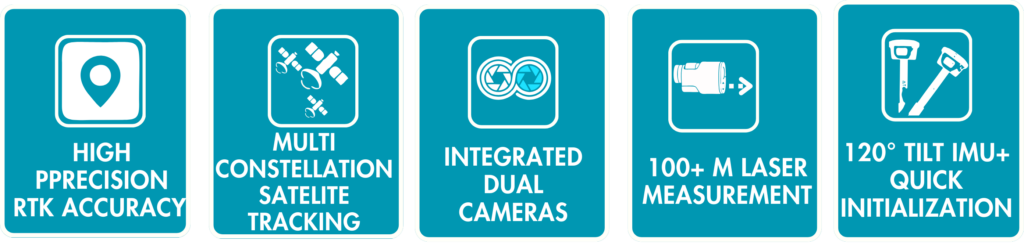

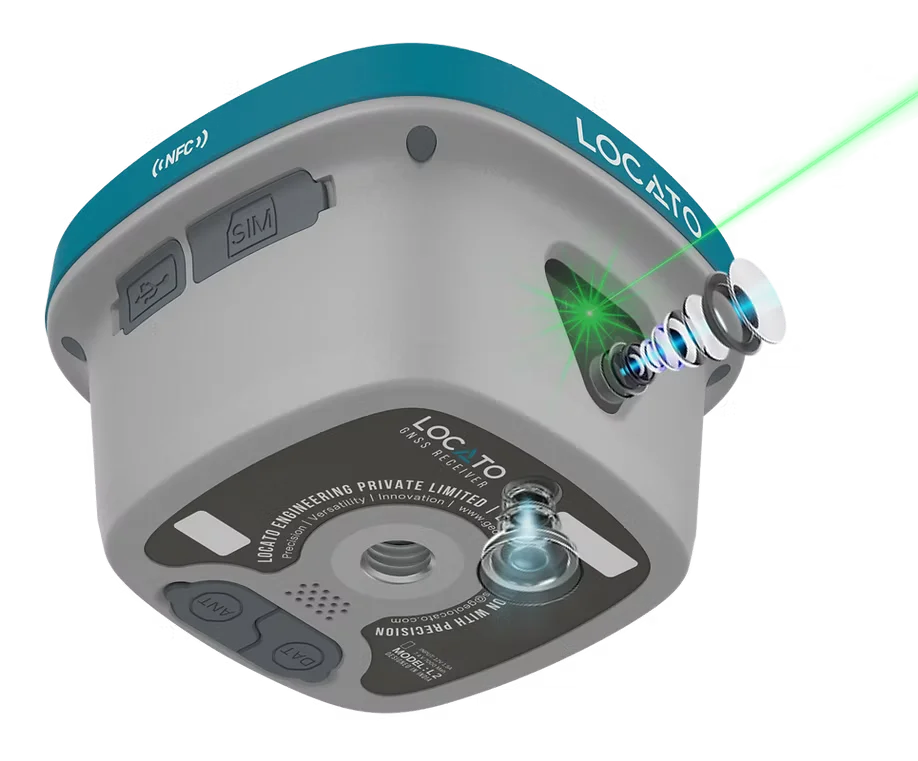
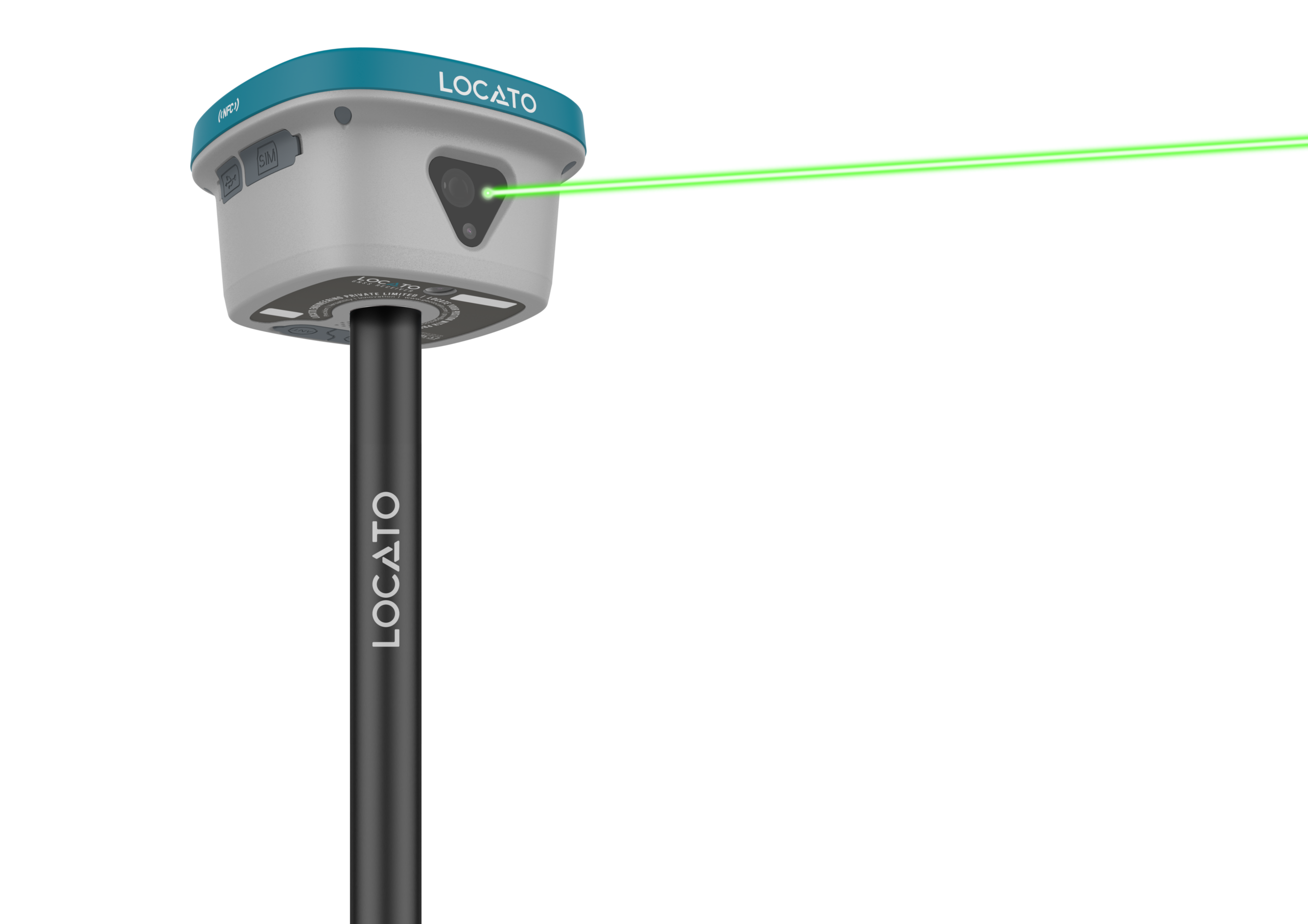
The combination of the EDM+Camera function, reduces the difficulty of working in special conditions, and fit the usage habits for surveyors. Camera can provide good viewing for sunlight and dark.
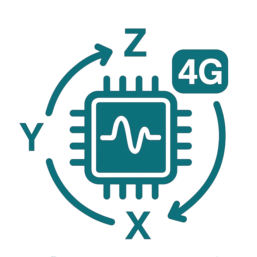
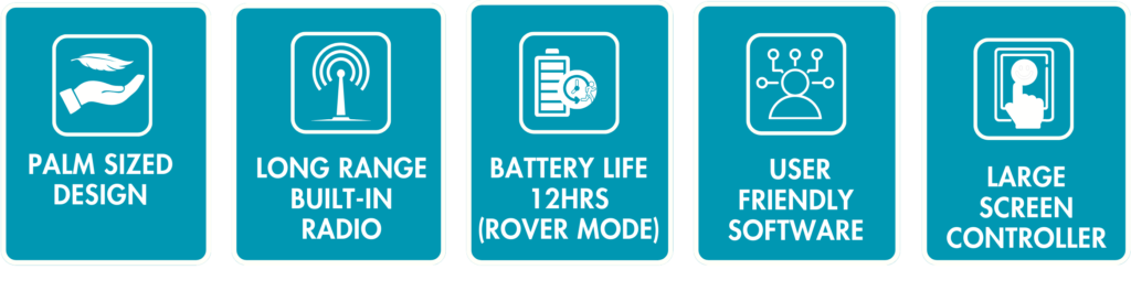
The newest IMU sensor makes the Tilt working more convenient, it eliminates the loss of Inertial-Measurement-Usable Status in most scenarios, no need frequency to shake the carbon pole and 120 degree tilt

With 7.4V 7000mAh capacity and quick charge technology, also power bank support , help you in full day working and continuous field working to improve your efficiency.

Support the full-frequency film RTK positioning solution The embedded multi-frequency point anti-interference technology. Significantly improved the initialization speed, measurement accuracy and reliability in complex environment

IP68 protection level, with over 30 times 2 meter fall down testing and water immerse inspection, it’s Seamless design to protect in cruel field working

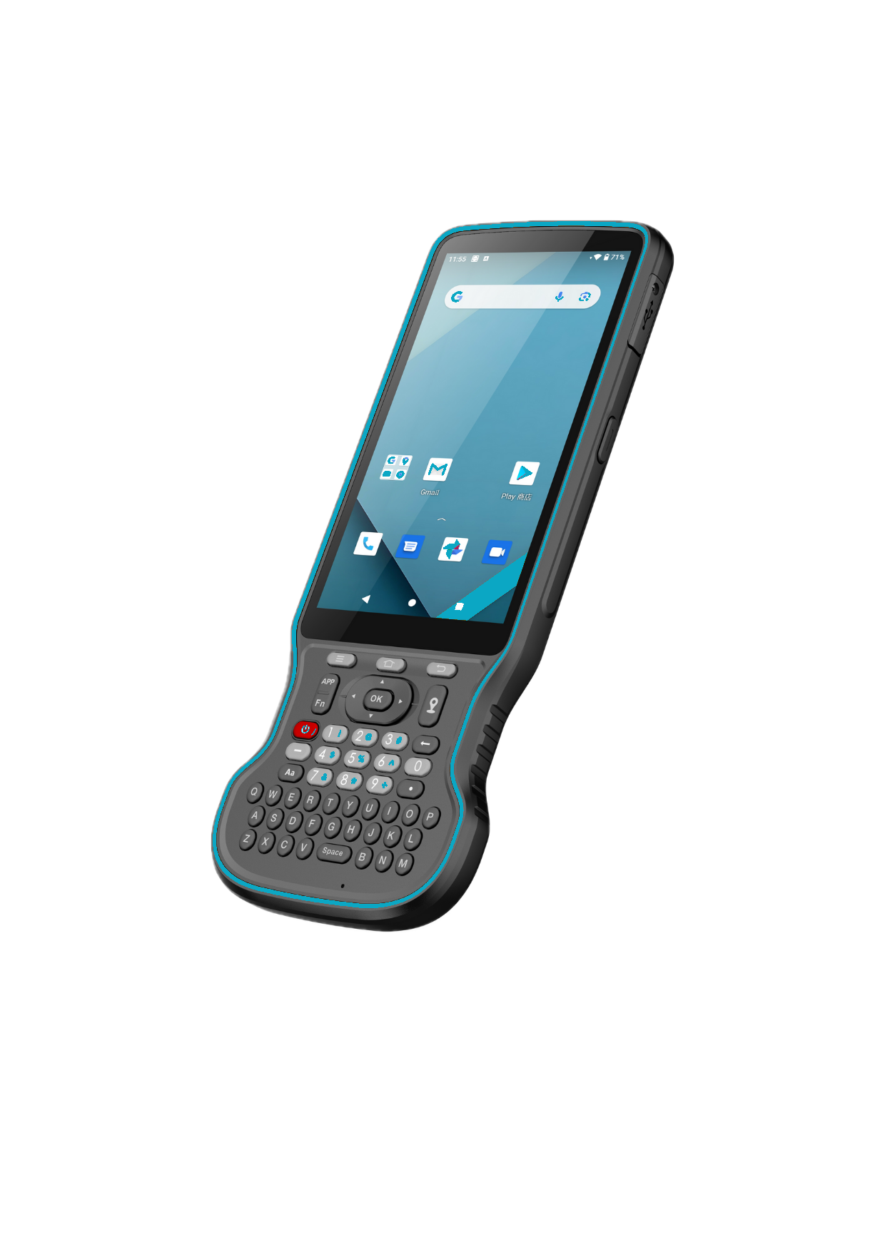
Immersive AR visual stakeout to vividly display ground stakeout points in the software, obviously improve the working efficiency

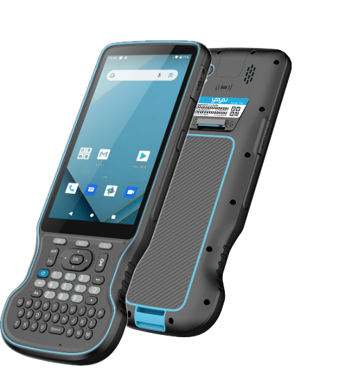
32GB internal memory is a valuable feature that can enhance the device's capabilities and streamline data management for users.

LOCATO L30 has an internal 4G modem that operates with more cellular network signals. A fast internet connection is guaranteed.

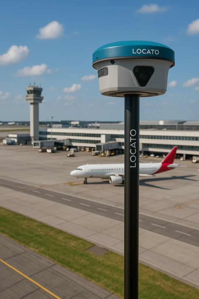
LOCATO’s CORS RTK is Kerala’s most advanced and trusted GNSS correction network, powered by a robust network of over 30+ Continuously Operating Reference Stations (CORS). Designed for professionals in surveying, construction, UAV mapping, and precision agriculture, it delivers centimeter-level RTK accuracy across the state.

The combination of the EDM+Camera function, reduces the difficulty of working in special conditions, and fit the usage habits for surveyors. Camera can provide good viewing for sunlight and dark.
The combination of the EDM+Camera function, reduces the difficulty of working in special conditions, and fit the usage habits for surveyors. Camera can provide good viewing for sunlight and dark.
The combination of the EDM+Camera function, reduces the difficulty of working in special conditions, and fit the usage habits for surveyors. Camera can provide good viewing for sunlight and dark.
To become a leading global brand in precision GNSS technology by delivering reliable, innovative, and accessible hardware solutions built for the evolving needs of field professionals.
To become a leading global brand in precision GNSS technology by delivering reliable, innovative, and accessible hardware solutions built for the evolving needs of field professionals.
The combination of the EDM+Camera function, reduces the difficulty of working in special conditions, and fit the usage habits for surveyors. Camera can provide good viewing for sunlight and dark.
The newest IMU sensor makes the Tilt working more convenient, it eliminates the loss of Inertial-Measurement-Usable Status in most scenarios, no need frequency to shake the carbon pole and 120 degree tilt
With 7.4V 7000mAh capacity and quick charge technology, also power bank support , help you in full day working and continuous field working to improve your efficiency.
Support the full-frequency film RTK positioning solution The embedded multi-frequency point anti-interference technology. Significantly improved the initialization speed, measurement accuracy and reliability in complex environment
IP68 protection level, with over 30 times 2 meter fall down testing and water immerse inspection, it’s Seamless design to protect in cruel field working
Immersive AR visual stakeout to vividly display ground stakeout points in the software, obviously improve the working efficiency
32GB internal memory is a valuable feature that can enhance the device's capabilities and streamline data management for users.
LOCATO L30 has an internal 4G modem that operates with more cellular network signals. A fast internet connection is guaranteed.
With 7.4V 7000mAh capacity and quick charge technology, also power bank support , help you in full day working and continuous field working to improve your efficiency.
Support the full-frequency film RTK positioning solution The embedded multi-frequency point anti-interference technology. Significantly improved the initialization speed, measurement accuracy and reliability in complex environment
The combination of the EDM+Camera function, reduces the difficulty of working in special conditions, and fit the usage habits for surveyors. Camera can provide good viewing for sunlight and dark.
The newest IMU sensor makes the Tilt working more convenient, it eliminates the loss of Inertial-Measurement-Usable Status in most scenarios, no need frequency to shake the carbon pole and 120 degree tilt
IP68 protection level, with over 30 times 2 meter fall down testing and water immerse inspection, it’s Seamless design to protect in cruel field working
Immersive AR visual stakeout to vividly display ground stakeout points in the software, obviously improve the working efficiency
32GB internal memory is a valuable feature that can enhance the device's capabilities and streamline data management for users.
LOCATO L30 has an internal 4G modem that operates with more cellular network signals. A fast internet connection is guaranteed.
The combination of the EDM+Camera function, reduces the difficulty of working in special conditions, and fit the usage habits for surveyors. Camera can provide good viewing for sunlight and dark.
The newest IMU sensor makes the Tilt working more convenient, it eliminates the loss of Inertial-Measurement-Usable Status in most scenarios, no need frequency to shake the carbon pole and 120 degree tilt
With 7.4V 7000mAh capacity and quick charge technology, also power bank support , help you in full day working and continuous field working to improve your efficiency.
Support the full-frequency film RTK positioning solution The embedded multi-frequency point anti-interference technology. Significantly improved the initialization speed, measurement accuracy and reliability in complex environment
IP68 protection level, with over 30 times 2 meter fall down testing and water immerse inspection, it’s Seamless design to protect in cruel field working
Immersive AR visual stakeout to vividly display ground stakeout points in the software, obviously improve the working efficiency
32GB internal memory is a valuable feature that can enhance the device's capabilities and streamline data management for users.
LOCATO L30 has an internal 4G modem that operates with more cellular network signals. A fast internet connection is guaranteed.
LOCATO’s CORS RTK is Kerala’s most advanced and trusted GNSS correction network, powered by a robust network of over 30+ Continuously Operating Reference Stations (CORS). Designed for professionals in surveying, construction, UAV mapping, and precision agriculture, it delivers centimeter-level RTK accuracy across the state.
With the integration of state-of-the-art VRS (Virtual Reference Station) technology, our network ensures superior positional accuracy by dynamically generating virtual base stations near the user’s location — eliminating the need for local base setups.
CORSRTK provides real-time corrections via GPRS, making high-precision positioning simple, fast, and reliable. Its plug-and-play connectivity enables seamless integration with GNSS receivers, offering a smarter, more efficient way to work — anytime, anywhere in Kerala.
LOCATO GNSS receivers are built to meet the demands of modern professionals — whether you’re mapping, surveying, or integrating with smart systems. No noise, just reliable tech that works where it matters.
The Most Trusted Real Time GNSS Positioning Service in Kerala
Don't have an account yet? Sign up
No products in the cart.
